The Whakatikei is a rugged part of the Akatarawa range that drains eventually into the Hutt river. It is targeted eventually to be the next dam site for Wellington water consumers. But at the moment it is just a beautiful mostly prisitine hidden gem on the edge of our capital city.
The headwaters of the Whakatikei is the east tending stream in the middle of this (old) photo.
The first task was to get to Paekak, and in true carbon conscious fashion we took the train. Note to self, "trains run on time". Reunited we headed out through Paekak cutting through some farmland on QE 2 park (or maybe not - see land boundary below Mick) to McKays crossing, and then up through the old Whareroa farm which is being actively developed with walking tracks as part of a green corridor from the sea to the hills.

There were no tracks where we were going however. Straight up the hill following a fenceline watching the ocean and Kapiti island grow bigger behind us.

Wainui is capped by a couple of hundred metres of bush and we soon ploughed into this following a rough, but appreciated route, marked by a local DOC ranger, at 722 metres Wainui peers down at a fault line running along its western foot known more commonly as transmission gully, but in the mist we couldn't see much at all.
![]()
![]()
For us there was only time for some preventative foot action.

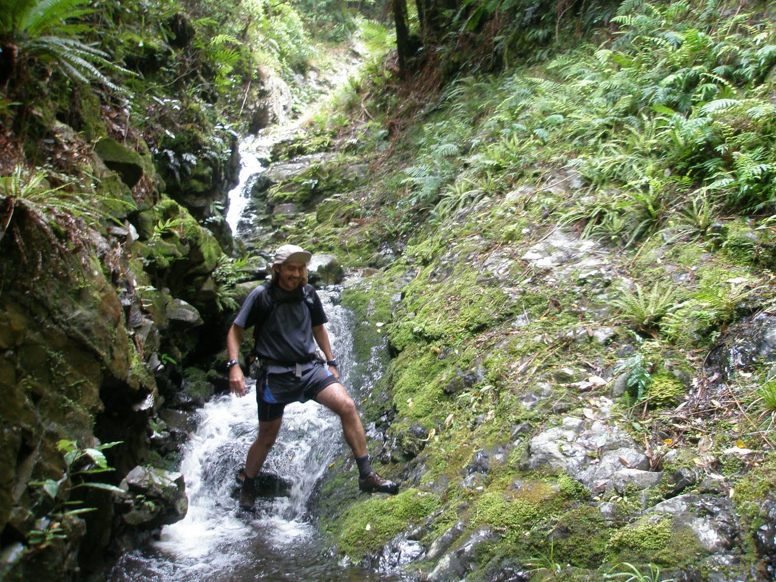
And them it was down into the creek, and what a little beauty it is, slimy rocks quickly give way to bigger grippier bouders or level riverbed to gallop down, and the trees are big, rata, rimu and the other podocarps tower all around when the lower canopy parts from time to time. Or they fall and provide obstacles or features in the gorge.
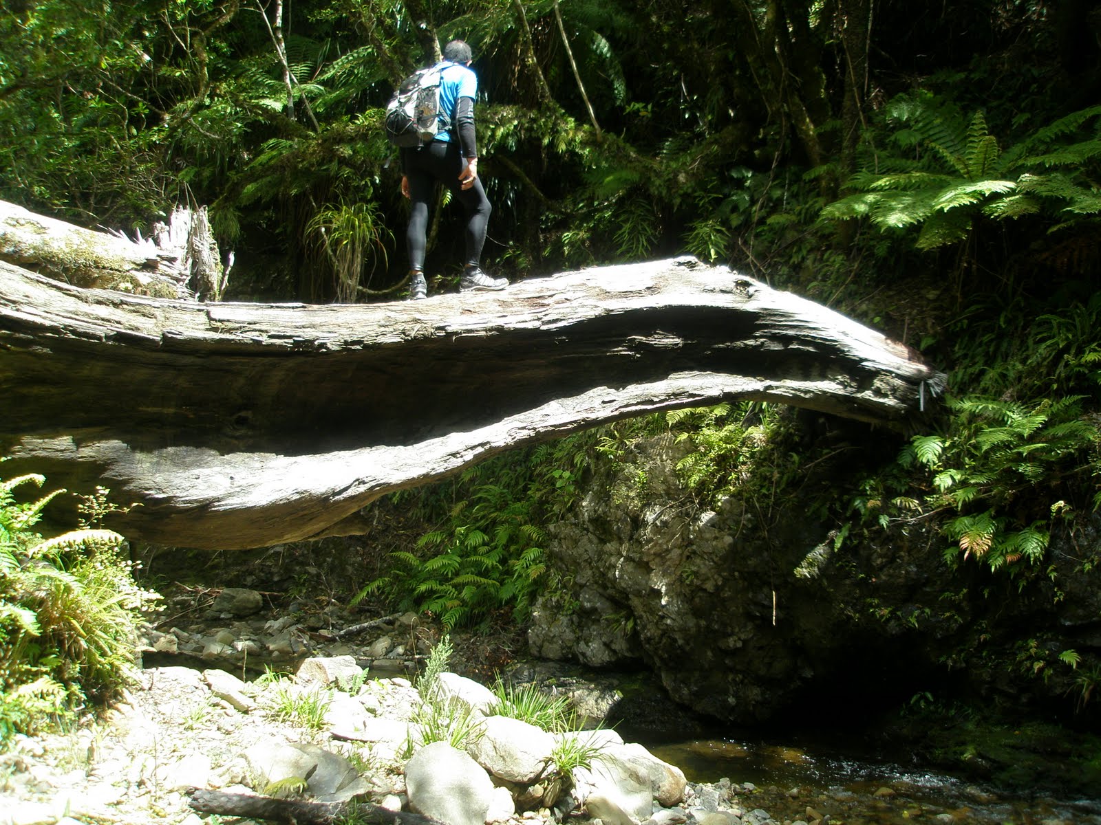
We had the occasional swim or scramble. It wasn't warm out of the sun, but even in the deepest confines of the valley the sun was never far away.


Out eventually, and it was power lines that signalled our return to civilisation, or not. We were at least out of the gorge, but we were still in the middle of nowhere. It made me reflect that in New Zealand some of our best adventures are in "pylon country" where electricity infrastructure required the battering out of roads across hostile terrain. I'm thinking the Borland Road, Dennistoun to Lyall on the Buller, McKenzie pass down south. Pylons can be beautiful with history and nostalgia on their side.
Being in the middle of nowhere we walked around the corner and bumped into "Orange Hut". The mythical heart of trail bike and 4wd drive culture around Wellington. True to its name it is painted Tui colours (as in the beer) and smells of man. Outback man. A concrete silo with bunks its austerity is only just resistant to the the type of graffiti and abuse that huts within reach of petrol powered transportation are subjected to. Mores the pity, it is a good spot.
It was here that we bailed, turning our backs of the further river journey opportuned and heading home with our tails between our legs, following the pylons back to Whareroa and down the hill. A good mission left incomplete for another time.
2 comments:
Hey bro, don't worry we're 3/4 of the way now, once my bionic knees arrive in the mail from eBay we'll go for the full mission! The mini-vid of the top half is at http://www.youtube.com/watch?v=P2OvBMN--Co
Yeah, or maybe we could just start at the top of the bottom gorge, do that then we are done! It could be an afterwork mission (with a shuttle maybe)
Post a Comment